|
When Earth first formed the distribution of land and water was
very different than it is today. Each of the world's continents lie
on tectonic plate,
like pieces of a giant jigsaw puzzle. These plates float
atop a giant ocean of magma and "drift" slowly in response to flows
of this magma. Drifts speeds are millimeters to centimeters per year,
but Over millions of years, the continents shift significantly
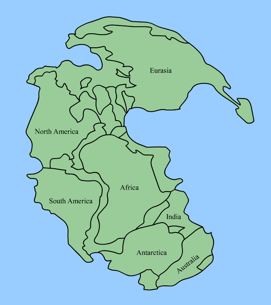
relative to one another. About 225 million years ago, all of
the continents were actually connected in a single landmass called
Pangaea.
Follow these links to learn more about plate tectonics, and to see a future
configuration of the continents. 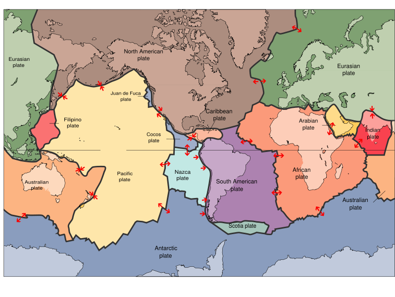
 Return to the Astronomy Workshop